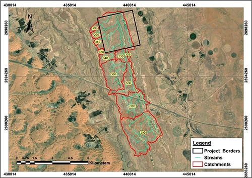
Hydrological and topographical assessment to mitigate flood risks for Qassim Power Station (covering approximately 200,000 m²). This study identified flood-prone zones and proposed measures such as culverts, open channels, and slope modifications to protect power infrastructure during intense rainfall events.